

The RIC Survey team has the experience and technology necessary to provide virtually any type of survey. RIC survey staff regularly establish horizontal and vertical control networks that are needed for the topographic, boundary, and utility surveys required to complete ALTA/NSPS surveys and engineering design surveys. Our survey crews travel in fully-equipped trucks that include survey-grade GNSS receivers with base units and radios, robotic total stations, levels, and if required, a survey-grade terrestrial scanner and an ATV with a trailer. The software utilized by our office staff include Carlson Survey, AutoCAD, MicroStation and Leica Cyclone.
RIC’s approach to land surveying combines technical expertise with flexibility and responsiveness to our clients’ needs. By emphasizing a high-quality, responsibly executed process, our clients can trust the accuracy of our results.
The RIC team is focused on incorporating cutting edge technologies to help increase project efficiencies and accuracy as much as possible. From capturing detailed as-built conditions with our 3D Scanner to acquiring high-resolution aerial mapping with our drone, we have the high-end technologies to meet the unique needs of our clients.
Services
- 3D Scanning
- ALTA Surveys
- As-Built Survey
- Boundary Surveys
- Building/Column Layouts
- Construction Staking
- Department of Transportation Surveys
- Digital Terrain Models
- Easement & Exhibit Documents
- Engineering Design Surveys
- Infrastructure Inventory
- Land Acquisition Surveys
- Land Development Surveys
- Mine Survey
- Oil and Gas Facility Surveys
- Pipeline Staking
- Property Research
- Right of Way Surveys
- Route Surveys
- Subdivision Plats
- Topographical Surveys
- Tree Inventory
- Utility Surveys
- Water Resources Surveys
- Wetland Location Surveys
- Aerial Data (High Resolution Imagery, UHD Video, LiDAR, Infrared)
Featured Projects
-
Ash Street Storm Drainage Improvements
Ash Street Storm Drainage Improvements
×This project includes removal of the existing low water crossing, design of a replacement drainage structure, raising the vertical profile of Ash Street, removal of the existing CMP culvert under Lexington Street, and other necessary modifications to Ash Street and Lexington Street to tie the proposed improvements into the surrounding area. The project includes a survey of existing conditions, utility coordination, cost estimates, acquisition documentation needed for any right-of-way or easements, developing construction plans in accordance with Harrisonville design criteria and specifications, coordination with utilities and Harrisonville, and assistance with bidding of project for construction. The project is funded through the Federal ARPA program. RIC is working with the city to ensure that the project meets the ARPA requirements for funding.
Location
Harrisonville, MO
Services
Markets
-
Children’s Mercy Park 3D Scan
Children’s Mercy Park 3D Scan
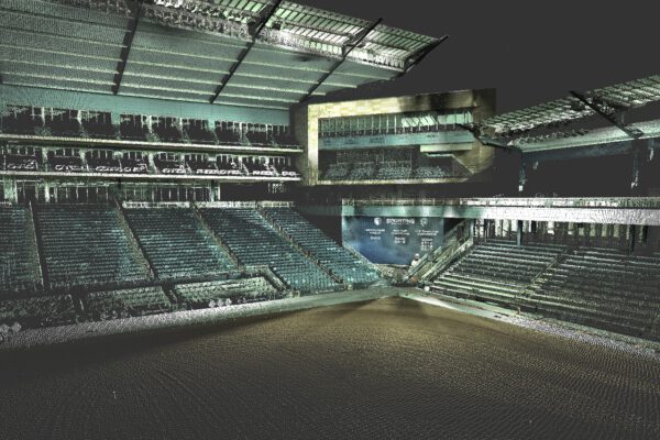
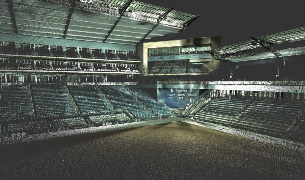
×Children's Mercy Park, home of Sporting KC, was interested in a 3D Scan with heat map to determine any low or high spots on the field. The Park’s field specialists were able to utilize the data captured to fix the different elevations prior to the beginning of the soccer season.
RIC’s 3D scanning service is an efficient and accurate way to capture and confirm as-built conditions. Our all-in-one Leica Laser Scanner gives our as-built, topographic, and mapping surveys an unprecedented level of accuracy, productivity, and versatility. Potential applications include bridge surveys, as-built surveys, historic restoration, engineering, topography, rail, and transportation.
-
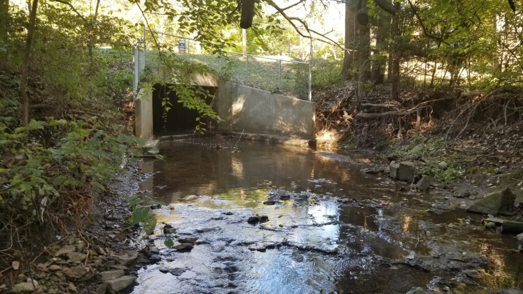
Buckeye Creek Bank Stabilization
Buckeye Creek Bank Stabilization
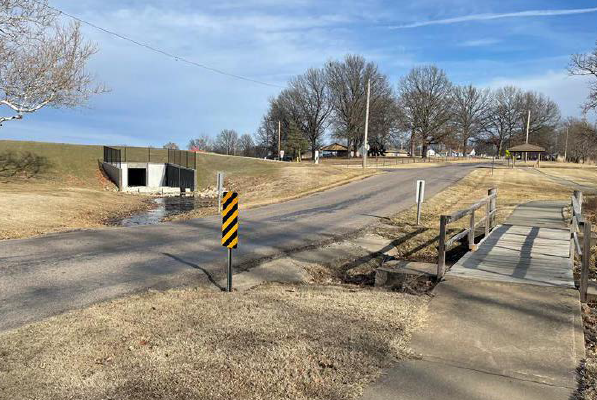
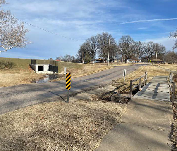
×RIC teamed with Water Resources Solutions to provide stream assessment, bank stabilization, and replacement of a low water crossing within the Kansas City, Missouri Parks and Recreation Buckeye Creek Greenway. RIC was responsible for survey, one dimensional hydraulic modeling, conceptual and final designs.
RIC’s surveyors and engineers provided topographic and boundary surveys, legal descriptions, HEC-RAS modeling, site grading and drainage design, bridge design, and utility coordination. RIC coordinated with KC Parks and Recreation and KC Water Services in order to maintain an accelerated project schedule desired by the Parks Department. RIC also assisted Parks in pursuing additional project funding. The project included overall stream assessment within the Greenway, removal of an existing low water crossing, design of an ambulance load-rated pedestrian bridge to replace the low water crossing, and bank stabilization throughout the project area. Bank stabilization work included correcting the undermining of an existing road that serves the Greenway and prevention of a cutoff at a meander bend that was in danger of occurring which would form an oxbow and bypass an existing pedestrian bridge that serves an adjacent neighborhood.
Projects
-
Mission Rd, 127th St to 133rd St
Mission Rd, 127th St to 133rd St
×RIC provided design services for improvements to Mission Road in Leawood, KS from 127th Street to 133rd Street. The project included widening roadways at intersections to accommodate bike lanes and required mill/overlay and restriping for the bike lanes. Improvements also included the burying of overhead utilities, metal pipe replacement, a storm sewer extension into Gezer Park, replacement and reconstruction of the sidewalk on both sides with 8’ sidewalks, and installation of LED light fixtures on existing poles.
Traffic Engineering services included a traffic signal warrant study at Mission Road and 127th Street and design services for a new High-Intensity Activated crosswalk (HAWK) pedestrian signal in front of Mission Trail Elementary School. Other services rendered included pavement markings, temporary traffic control, permanent signage, and street lighting improvements.
Location
Leawood, KS
Markets
-

Spring Hill Middle School
Spring Hill Middle School
×RIC provided surveying and civil engineering for a new middle school for the Spring Hill School District. The new 100,000 square foot school is located on 32.9 acres off of 167th Street and Lindenwood in Olathe, KS. The school has a football field, track, track and field jumping and throwing areas, a baseball field, and outdoor basketball courts. RIC designed a parking lot with 353 parking stalls, a bus drive, and a drive for parents to pick up and drop of their children. We also provided preliminary design for South Lindenwood Drive, the public street which will provide access to the school. RIC is performing the following services for this project; boundary and topographic surveying, storm sewer design, site/civil design, grading, sanitary sewer design, water line and BMP design.
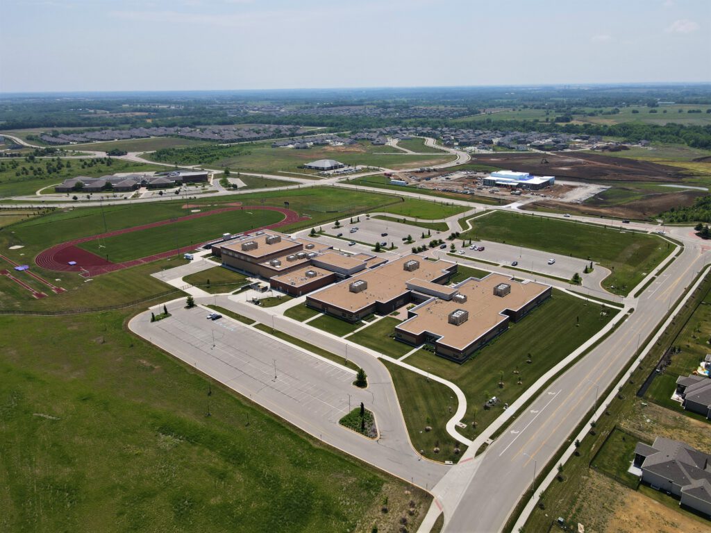
Location
Spring Hill, MO
Services
Markets
-
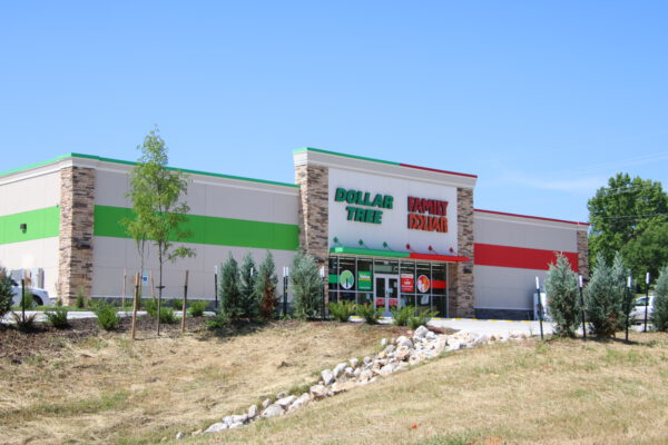
Family Dollar Program
Family Dollar Program
×RIC provided civil design, surveying, and easement services for many of the new Family Dollar’s located primarily in Missouri and throughout the Midwest. Starting in 2020 and is currently ongoing, we have provided services to several Family Dollar locations. Each of these buildings are brand new and designed to help develop and drive the local economy of the towns they are situated in. Each location has its own set of unique challenges that make it an interesting treat to work on each project.
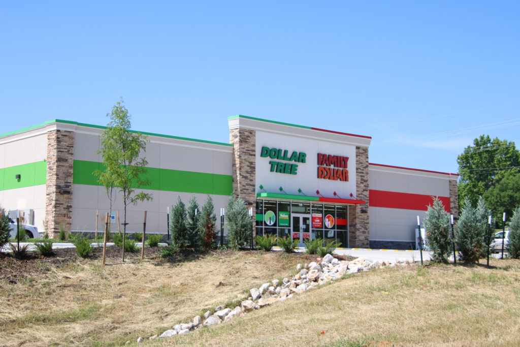
Location
Various Locations
Markets
-
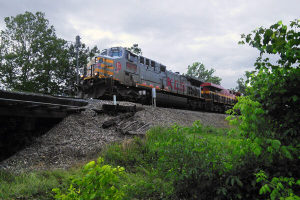
DeQueen Track Shift Project
DeQueen Track Shift Project
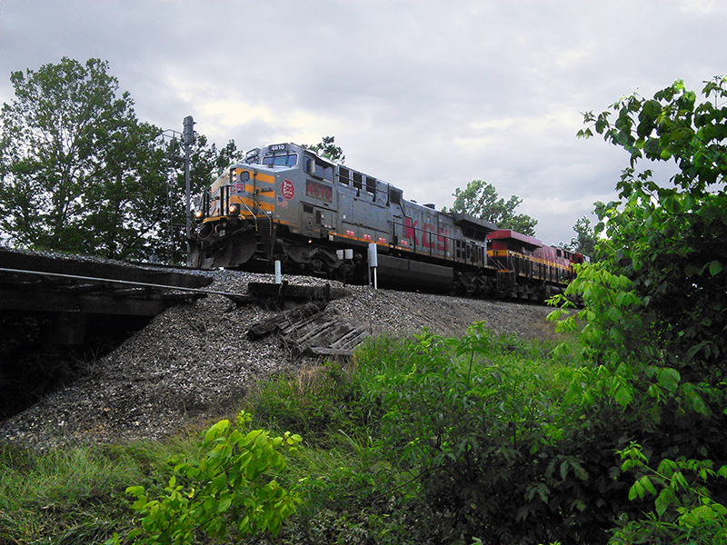
×RIC holds a Master Services Agreement with the Kansas City Southern Railway Company (KCS) and serves them on a systemwide basis. KCS wished to address a bridge replacement, operations, and speed restrictions throughout the DeQueen Corridor.
RIC served KCS as the overall Project Manager, coordinating all activity for the design of a new 148’ long bridge and approximately 1100 feet of new mainline track as part of the DeQueen project. The project goal was to have the proposed mainline for 40 MPH and the connection of several yard tracks associated with the construction of the proposed mainline track.
RIC coordinated with Geotechnical, Environmental, and the KCS Bridge Consultant to ensure seamless integration of all design components of the project. Our work also included all utility coordination and the field location of all crossings under the proposed track including two active sanitary sewer lines (1-10” and 1-15”), a 12” water transmission main that served the City of DeQueen and an 8” high-pressure gas main. This project is currently on hold at 60% design, as we stand by for further communications from KCS.
-
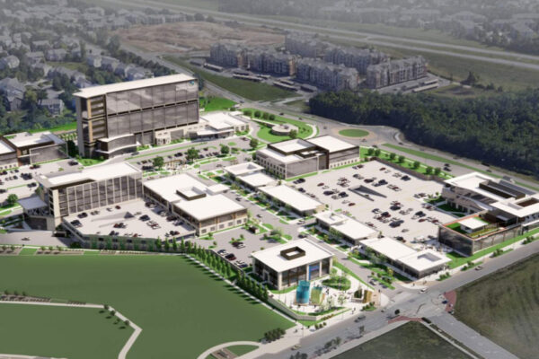
AdventHealth at Lenexa City Center
AdventHealth at Lenexa City Center
×RIC is providing civil engineering and landscape architecture services for the new AdventHealth Facility located on the corner of 87th Street Parkway and Penrose Lane in the Lenexa City Center. Landscape planting and hardscape features are being prepared and updated through every phase of the project, including conceptual design, schematic design, design development, and construction documents. In addition, RIC is participating in budget meetings, preparing cost estimates and illustrative master plan drawings, and providing bidding assistance and construction administration services.
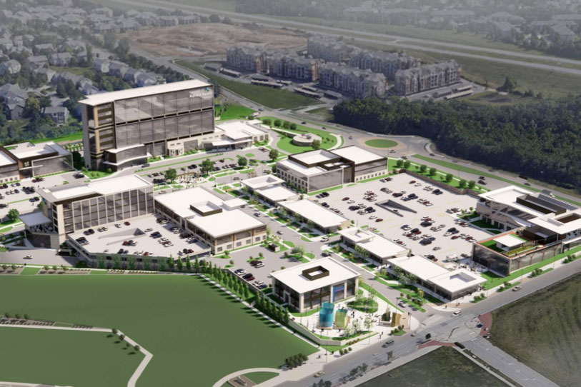
Location
Lenexa, KS
Services
Markets
-
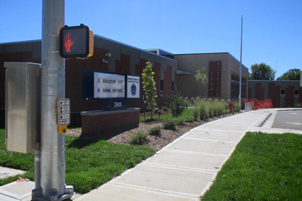
Frank Rushton Elementary School
Frank Rushton Elementary School
×The goal of USD 500 was to construct and commission the new Frank Rushton Elementary School while the existing elementary school remained in session on the shared 6 acre site. The project required not only final site utility design but also interim design to keep the existing school in service. The project employed a new enclosed storm sewer system in addition to permanent post construction water quality BMPs. Landscape architecture was provided for the entire site including the addition of a Community Garden. Pedestrian access was a key element of the project and RIC coordinated with local Safe Routes Engineering consultant on both interim and final design of sidewalks and cross walks adjacent to both the existing and proposed elementary schools. The project included; grading, new storm sewer system, new sanitary and water connections, parking and drive aisles, pedestrian access and landscape architecture.
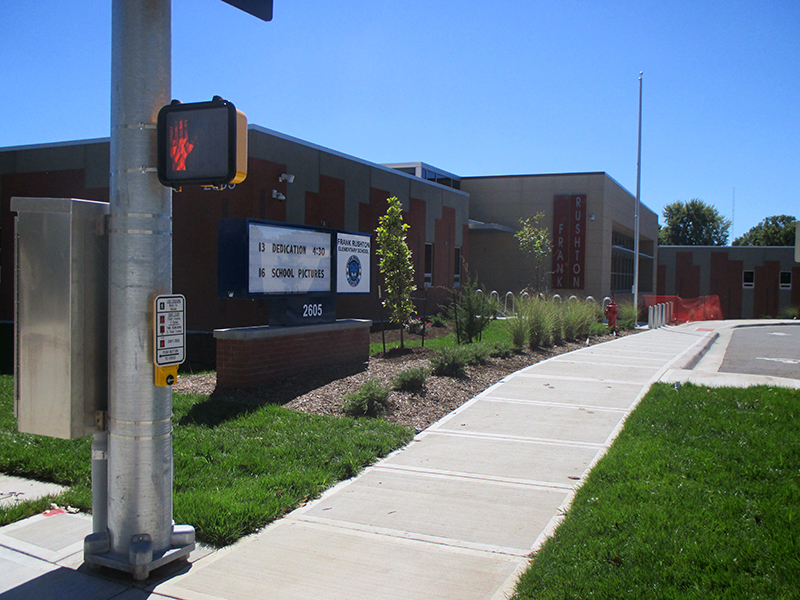
Location
Kansas City, KS
Markets
-

Orthopedic Health of Kansas City
Orthopedic Health of Kansas City
×RIC provided surveying and civil engineering for a 38,000 square foot medical office building located in North Kansas City, Missouri. RIC's scope of work included boundary and topographic survey, civil site plans, erosion control plans, and landscape plans including the design of rain gardens.
The project received the 2020 Capstone Award for Sustainability. A prominent sustainable feature was the 700+ solar panels that cover the parking area and provide 75% of the building's power.
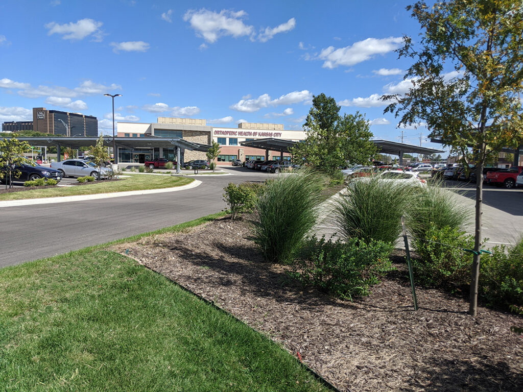
Location
North Kansas City, MO
Markets
-
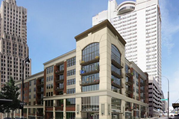
Power and Light Apartments
Power and Light Apartments
×RIC was the civil engineer on the historic Power and Light building renovation project in the heart of Downtown Kansas City. The renovation included converting a 32-story historic office tower into 215 luxury apartments. The project also included the construction of a new 4-story parking garage, a swimming pool and 53 new luxury apartments. RIC provided land disturbance plans, underground detention design, and public street improvement plans which included city sidewalks and ADA accessible ramp design.
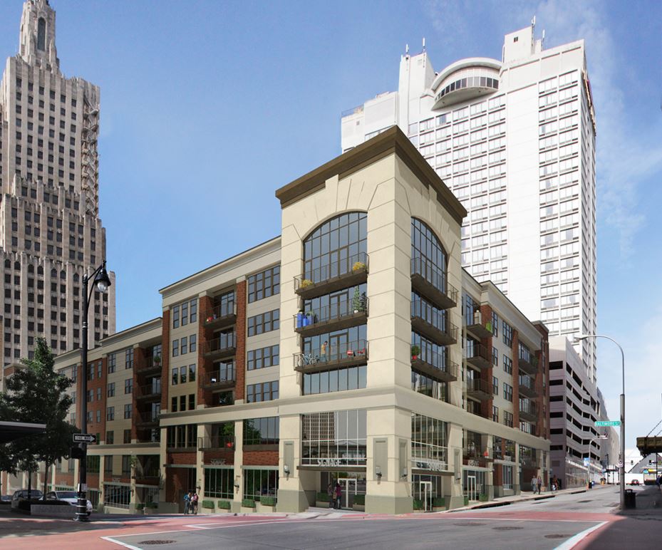
Location
Kansas City, MO
Markets
-
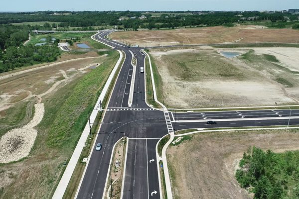
Ridgeview Road Design-Build
Ridgeview Road Design-Build
×RIC was on a design-build team for the new Ridgeview Road from Prairie Star Parkway to K-10. RIC was responsible for providing land surveying, roadway drainage and design, landscape architecture, design support during construction, public meeting attendance, utility coordination, as-built documents, and construction staking.
The new road consists of a four-lane divided arterial roadway with turn lanes, storm drainage facilities, street lights, traffic signals, sidewalks and trails. The project also included the construction of 99th Street from Ridgeview Road to Britton Street; 98th Street from Ridgeview Road east to the existing Meritex entrance; a westbound left-turn lane on Prairie Star Parkway at Ridgeview Road; and the re-alignment of the access road into the Johnson County Trailhead for the Little Mill Creek Trail.
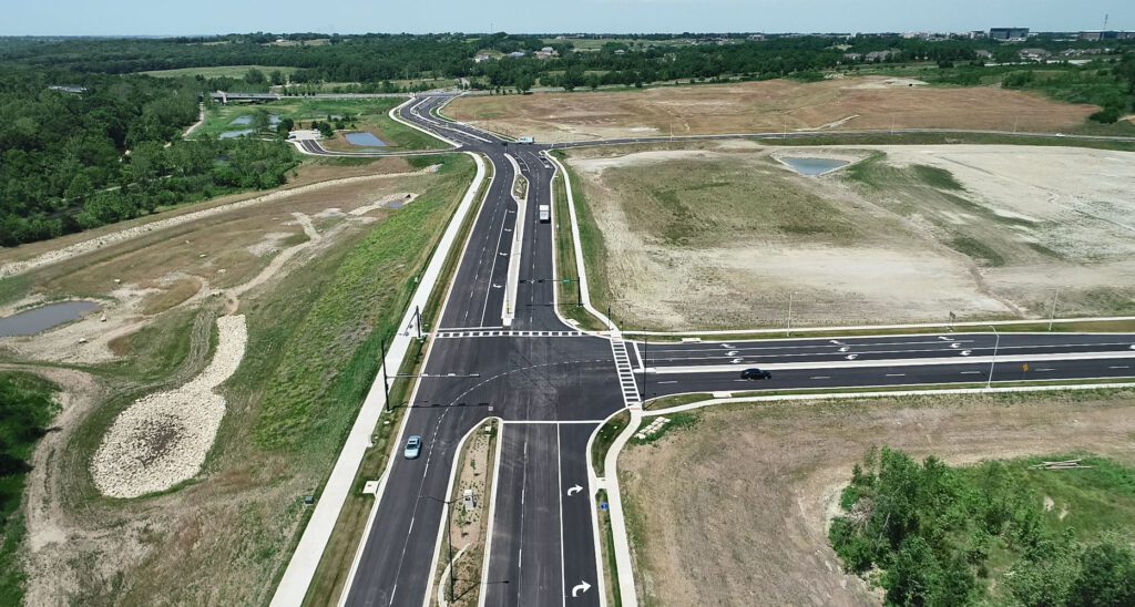
Location
Lenexa, KS
Markets
-
The Lofts at Lenexa City Center
The Lofts at Lenexa City Center
×RIC provided topographic and boundary survey, site development plans, stormwater report, easement and legal descriptions, preliminary and final plats, construction documents, landscape plans, public lighting plans, and construction administration for the development in Lenexa City Center. The Lofts contain over 9,000 square feet of office space on the first floor, four stories of apartments, and an underground garage with around 100 spaces.
Location
Lenexa, KS
Markets
-
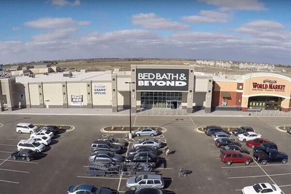
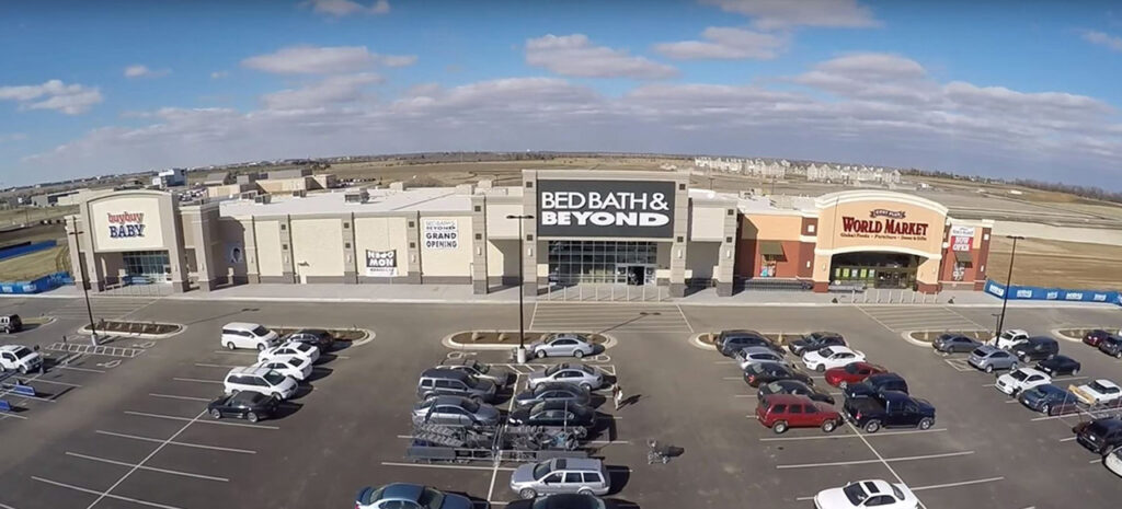
Wichita Destination Development
Wichita Destination Development
×RIC was contracted by Wichita Destination Developers, LLC to assist in the development of a 105 acre destination shopping and entertainment district. The complex is known as Greenwich Place and located at the Northeast corner of K-96 and Greenwich Road in Wichita, Kansas. The Greenwich Place tenants include: Buy Buy Baby, Ross, Mardel, Blaze Pizza, Charming Charlie, DSW, Cavender's, Home Goods, Maurices, Wichita Sports Forum, Stein Mart, Pizza Place, World Market, Bed, Bath, & Beyond, Ulta Beauty, LaQuinta Inn, Bling Glamour.
RIC’s responsibilities on this project include oversight of design of all site infrastructure including public water main extension, high pressure gas main relocation, sanitary sewer extension, public streets, storm drainage, stormwater water quality and system design, mass grading and construction contract administration.
The public water main extension incorporates the City of Wichita’s standard specifications, design criteria and standard plans including valves at appropriate junctions, hydrant sets, thrust blocking, blowoff assemblies and utility crossings.
The roadway portion of the project includes the design of Greenwich Court, a four-lane concrete pavement roadway serving access to the 105 acre shopping center and also included two round-abouts providing access to adjacent development areas. The project design included paving, grading, storm drainage, traffic control, right-of-way, utility coordination and landscaping. This portion of the project was financed with Kansas STAR Bonds.
-
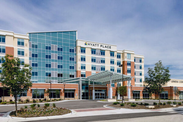
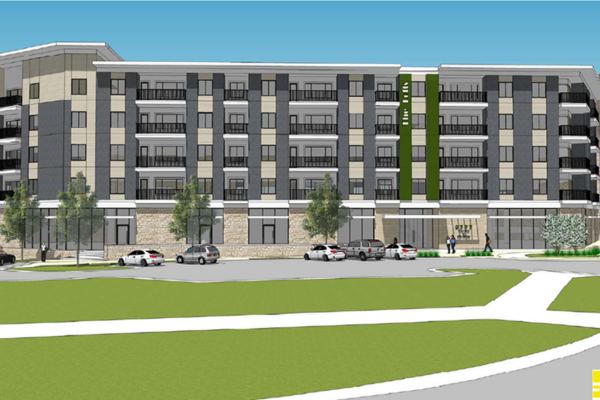
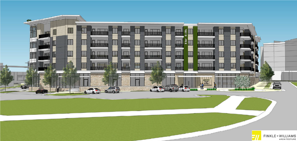
Hyatt Place Hotel at Lenexa City Center
Hyatt Place Hotel at Lenexa City Center
×The RIC team was responsible for zoning the property, preliminary development site plans, preliminary plat, final site plans, construction documents, public sanitary sewer plans, and public street storm sewer plans. The hotel boasts 127 guest rooms and a 14,000 square foot conference center.
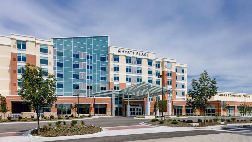
Location
Lenexa, KS
Markets
-
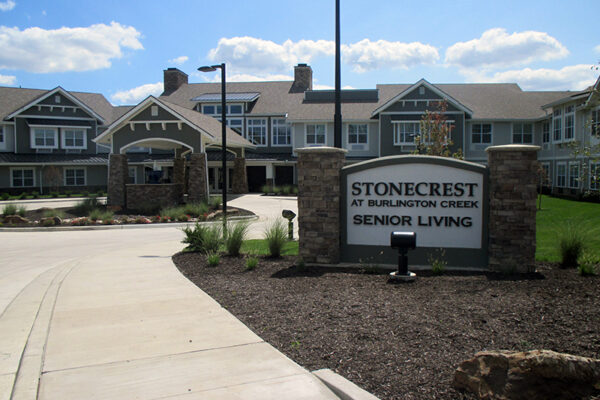
Stonecrest Senior Living at Burlington Creek
Stonecrest Senior Living at Burlington Creek
×Stonecrest Senior Living is a 58,052 square foot assisted living and memory care facility located in Burlington Creek. Under contract with NorthPoint Development, RIC performed entitlements, surveying, platting, landscape architecture, site/civil design including detention basin and water quality BMP design.
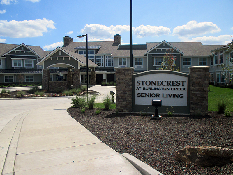
Location
Kansas City, MO
Markets
-

Covenant Place of Lenexa
Covenant Place of Lenexa
×This project included the construction of a senior living facility and all site improvements. RIC’s scope of services included surveying, rezoning, preliminary and final plans, design of grading, pavement, storm sewer, storm water detention, stormwater quality BMP’s, and erosion control.
Location
Lenexa, KS
Markets
-
67th St & Cottonwood Storm Drainage Improvements
67th St & Cottonwood Storm Drainage Improvements
×The City of Shawnee hired RIC to perform a Preliminary Engineering Study (PES) for an area along a tributary to Little Mill Creek near the intersection of 67th Street & Cottonwood Drive. Flooding problems in the area had been identified in the Mill Creek Flood Study previously completed. Existing reinforced box culverts under Cottonwood Drive and 67th Street are both topped during a 100-year storm event. This results in flooding of the homes on West 67th Street and makes the roads impassable for emergency vehicles. A church building upstream of 67th Street is also endangered by channel bank erosion. Proposed solutions in the PES include construction of larger box culverts under the road, bank stabilization, widening of the channel section, utility relocation and purchasing flooded homes.
RIC’s scope of work included topographic survey, hydrologic and hydraulic modeling, an opinion of probable costs, coordination with utilities, identification of future permitting requirements, public outreach, and preparation of the Preliminary Engineering Study. The study was prepared in accordance with requirements of the Johnson County Stormwater Management Program. The PES was submitted and accepted by the Johnson County Stormwater Management Program and has been placed on the list of potential funding in 2020.
Location
Shawnee, KS
Markets
-
Derby Destination II
Derby Destination II
×RIC was contracted by Derby Destination Development, LLC to perform survey for and design infrastructure improvements associated with the Derby Destination II Star Bond project. The infrastructure improvements included two phases of sanitary sewer main extensions. Phase I included approximately 2000 L.F. of sanitary sewer main extension to serve area of the proposed development north of Cambridge Street. Design of phase I begin in March 2020 and plans were released for construction in December of 2020. Construction began in early 2021 and was completed in summer of 2021. Phase II design was 90% completed in 2020 but held for construction until 2023. Phase II of the sanitary sewer included approximately 1100 L.F. of main extension to serve approximately 20 acres just north of Tall Tree Road. Phase II of the sanitary sewer is currently under construction and expected to be completed in summer 2023.
RIC’s responsibilities on the project included boundary and topographic survey, sanitary sewer design, preparation of construction drawings, permitting, easement documents, bid phase services, construction administration and preparation of as-built drawings.
Location
Derby, KS
Services
Markets
-
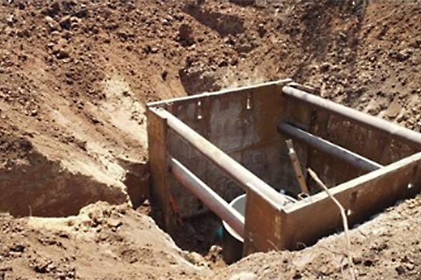
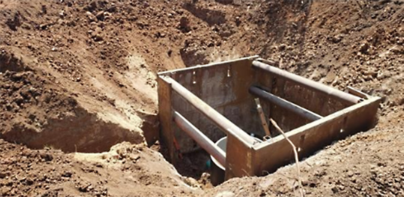
Compass 70 Development
Compass 70 Development
×RIC was hired by Scannell Properties to design a sanitary sewer collection system, lift station and force main to serve the 150-acre Compass 70 Business Park in Bonner Springs, KS. RIC worked with Scannell Properties and the City of Edwardsville to develop the design for the collection system and lift station. The project included approximately 1625 L.F. of 8” gravity main, 1016 L.F. of 4” force main and a lift station. The lift station was designed in conjunction with the City of Edwardsville design criteria and technical specifications, and input from the City’s on-call engineering consultants. The station was designed for a peak flow of 225 gallons per minute (GPM) for the proposed industrial park.
The lift station included submersible pumps in the wet well, valve and meter vault structures, control panel, electric meter, backup generator and a Primex Remote Operating System. The design process of the project included development of land disturbance plans and a Stormwater Pollution Prevention Plan (SWPPP). RIC also completed applications to KDHE for the project and obtained a Notice of Intent for Construction Activities and a Sanitary Sewer Main Extension permit. Project design started in Fall of 2021. Construction of the project began in Summer of 2022 and is expected to be completed in Summer 2024.

Location
Bonner Springs, KS
Services
Markets
-
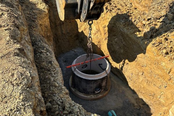
Cedar Mill 04 Water Main and Pump Station
Cedar Mill 04 Water Main and Pump Station
×provided survey, concept design, engineering and construction phase services for a pump station and force main to serve the 225 acres Heartland Logistics Park in Shawnee, Kansas. The project was a partnership between Blue Shawnee, LLC and the City of Shawnee, KS. RIC prepared a conceptual design memorandum for submittal to Johnson County Wastewater (JCW) outline the design criteria, area to be served by the pump station, preliminary pump station layout and force main alignment. After, approval of the conceptual design memo by JCW, RIC prepared construction plans, specifications and bid documents for approximately 800 L.F. of gravity sewer, a 640-gpm pump station and approximately 7700 L.F. of 10” HDPE force main including a 500 L.F. boring under K7 Highway.
The pump station site included a building to house electrical control, mechanical systems and future odor control system. A backup generator, parking area, site lighting and landscaping. RIC also provided shop drawing review, construction administration and full-time construction observation. The construction plans were approved by JCW in June 2021 and construction begin in September 2021 with completion Summer 2022.
Location
Shawnee, KS
Markets
-
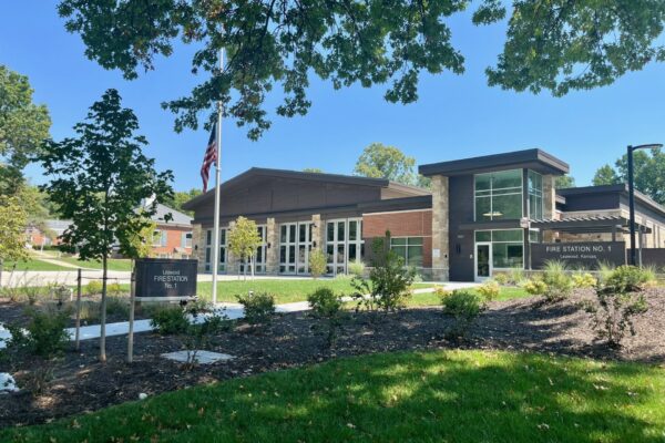
Leawood Fire Station No. 31
Leawood Fire Station No. 31
×RIC provided surveying, engineering, and landscape architecture services for the new Leawood Fire Station No. 31 in Leawood, KS. The new Fire Station was constructed to replace the existing undersized Fire Station No. 1. Fire Station No.31 was designed and constructed on the lot of the old Leawood Police Station. The new 14,200 SF Fire Station features four drive-through apparatus bays requiring a two-tier retaining wall system to open the required space needed. The site also features extensive landscape architecture to provide screening to the neighboring residential homes.
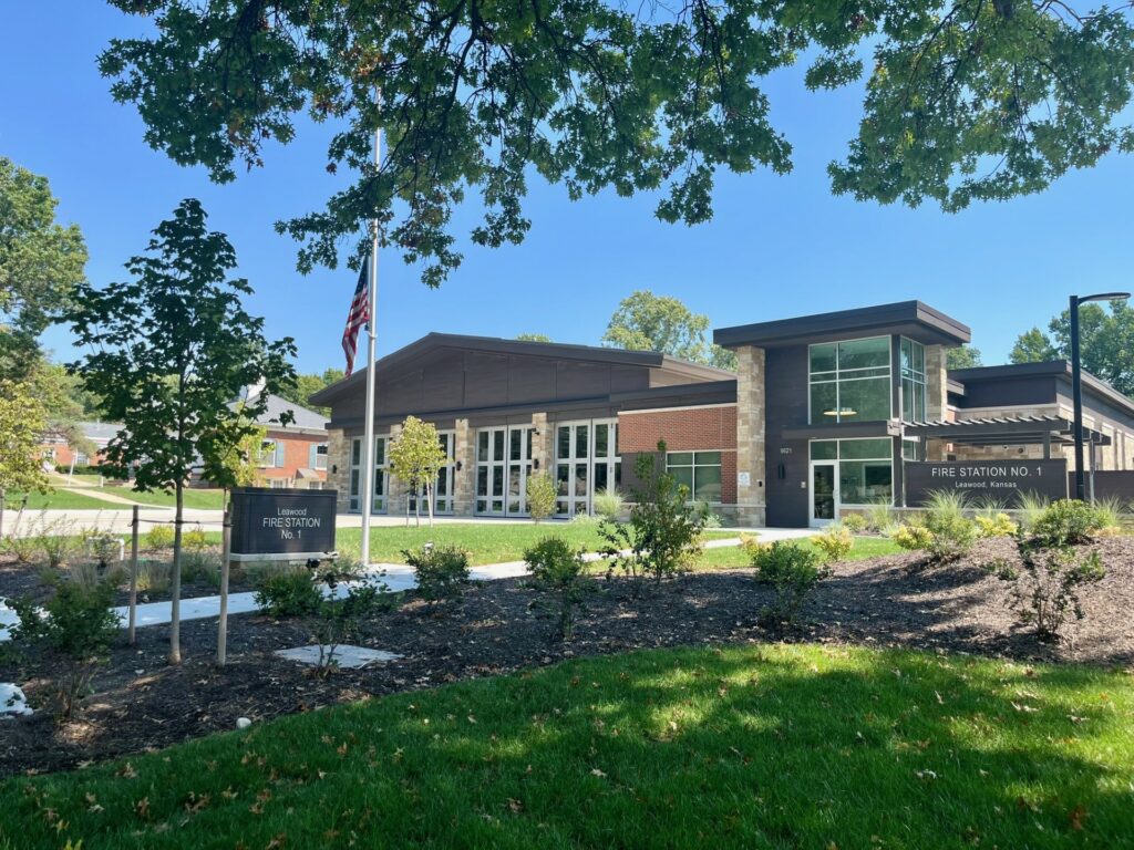
Location
Leawood, KS
Markets
-
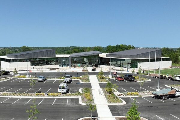
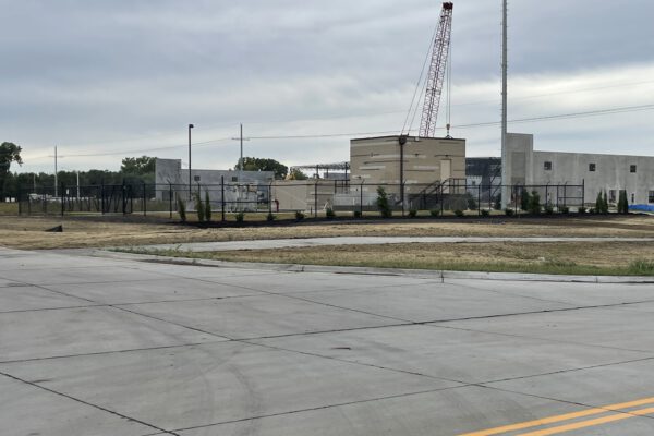
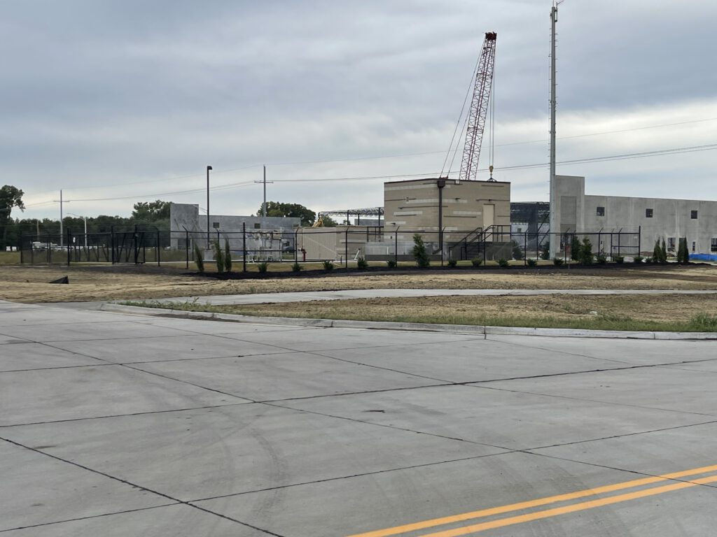
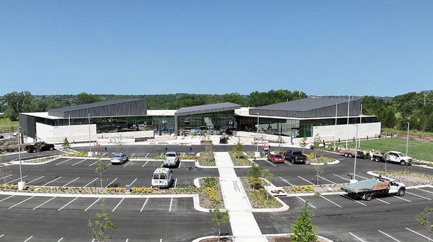
Lenexa Justice Center
Lenexa Justice Center
×RIC was hired by the City of Lenexa as part of the Finkle-Williams project team to provide civil engineering, survey, and construction phase services for the new Lenexa Justice Center, situated at the southwest corner of Prairie Star Parkway and Britton Street. Responsible for site engineering—including grading, drainage, and stormwater management—RIC also designed a public sanitary sewer main extension to support the two new buildings totaling approximately 75,000 square feet. The construction drawings for the sewer extension were developed in accordance with Johnson County Wastewater design criteria and technical specifications. The sewer main extension was successfully completed between January and May 2023. The project was completed in August of 2024.
-
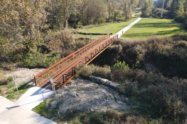
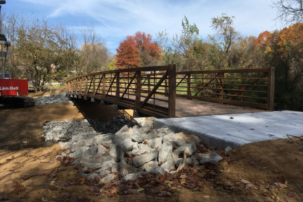
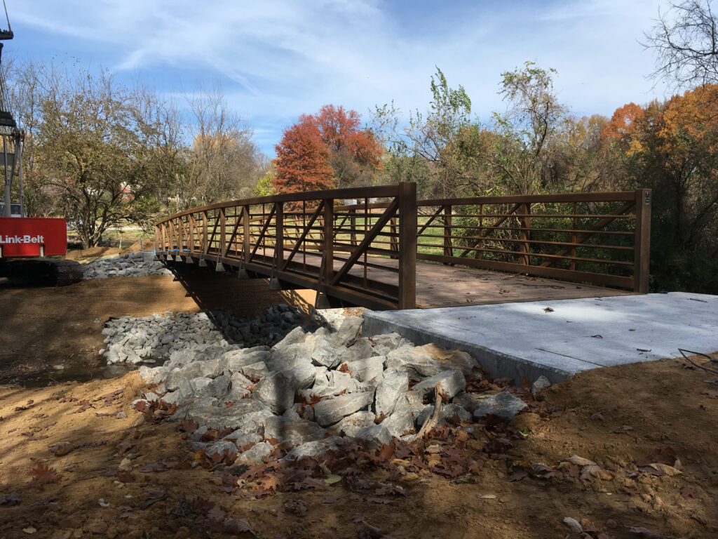
Thousand Oaks Brush Creek Connector Trail
Thousand Oaks Brush Creek Connector Trail
×RIC designed 3,500 linear feet of 10’ concrete trail to provide connection from the Thousand Oaks Subdivision to the existing Brush Creek Trail. The project included culvert design, FEMA floodplain modeling, and the design of a pedestrian bridge over Brush Creek. The project also included landscape architecture, parking lot rehabilitation and striping, utility coordination, and part time construction inspection.
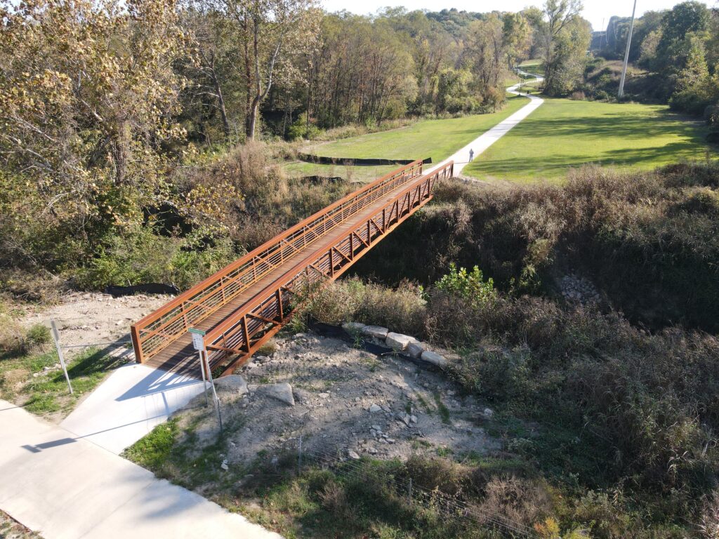
Location
Parkville, MO
Markets
-
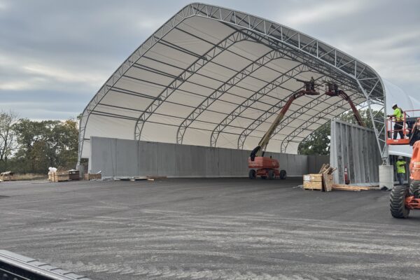
Olathe Salt Dome #2
Olathe Salt Dome #2
×Olathe Salt Dome #2 located adjacent to the Parks and Recreation Building. This dome will allow the city to move their salt storage out of the Meritex caves in Lenexa, making treatment more convenient.
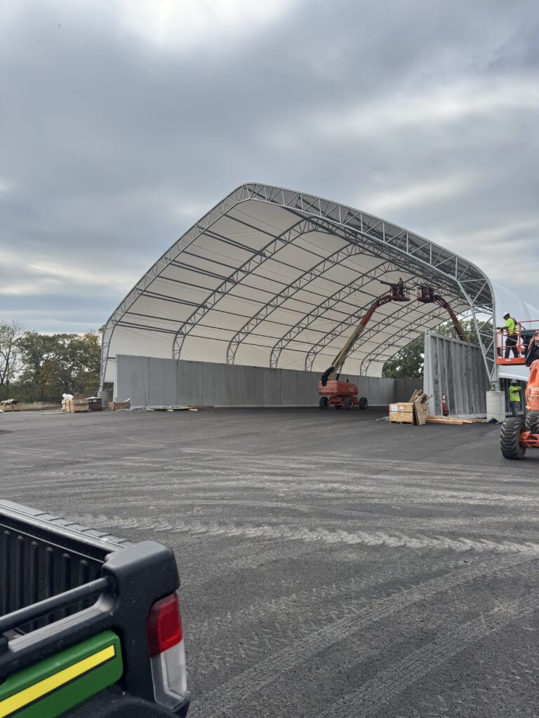
Location
Olathe, KS
Markets