
Our Aerial Solutions team is focused on supporting a variety of industries and clients with quality aerial-acquired data and applicable solutions. This data includes ultra-high definition (UHD) videography and high-resolution photography used for aerial mapping to support civil engineering, architectural, and GIS projects. The HD imagery and video is a useful tool for detailed analysis of infrastructure inspections. This information is acquired using Unmanned Aerial Vehicles/Systems (UAV/UAS) or via partnerships with manned fixed-wing and rotor-wing aircraft service providers.
Use of UAS significantly reduces safety concerns, acquisition costs, and services response times. This provides a more efficient and effective project workflow.
Services
- Aerial Mapping
- Augmented Reality/GIS Overlays over 6K UHD Video
- Client Assets Documentation/GIS
- Construction Monitoring
- HCA Corridor Visual Documentation
- Hyper-Spectral Sensor Technologies
- Infrared Inspections & Analysis
- Infrastructure Inspections & Analysis
- Infrastructure Visual Documentation
- LiDAR
- Multi-Spectral
- Preliminary Reconnaissance
- Right-of-Way Corridors
- Surface Modeling
- Vegetation Analysis Surveys
- Volume Analysis
Featured Projects
-
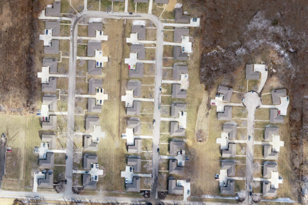
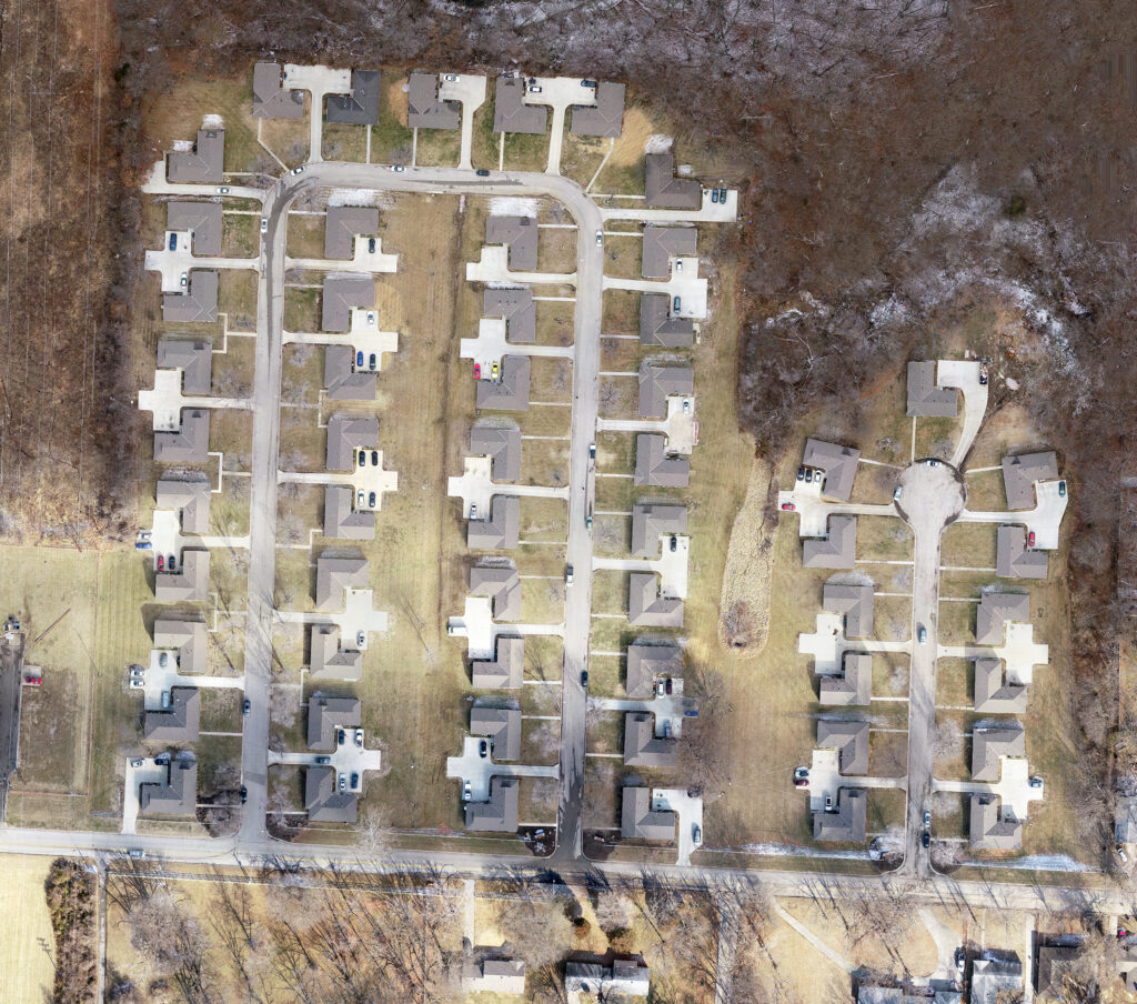
Roseland Court Duplex UAS & ALTA Survey
Roseland Court Duplex UAS & ALTA Survey
×RIC recently provided an As-Built ALTA/NSPS Land Title Survey for the Roseland Court Duplexes located in Kansas City, MO. RIC’s Survey Field Crew joined forces with RIC’s Commercial Drone Services to capture UAS data utilizing our drone. The drone acquired imagery was processed into a highly accurate Orthomosaic Image for use in feature extraction of all planimetric features of the street, curbs and gutter, sidewalks, above ground utilities, and housing units.
RIC’s Survey Field Crew provided Ground Control Points for the UAS image acquisition flight and acquired supplemental measurements to verify the location of housing units and boundary reconciliation.
-
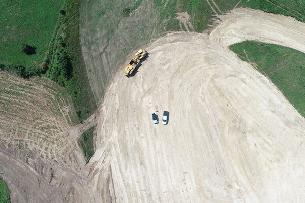
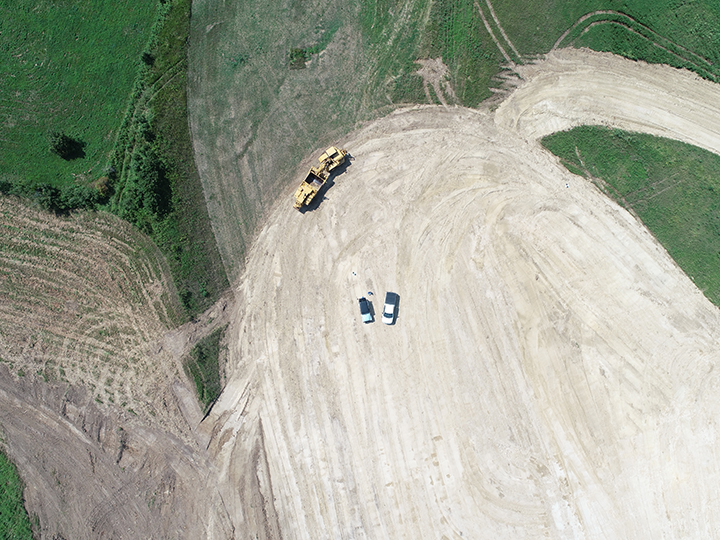
UAS Volume Analysis
UAS Volume Analysis
×RIC provided bi-weekly volume analysis of a 25-acre Borrow Pit for Linaweaver Construction utilizing RIC's drone. This service was to disclose overall quantities to one of their clients over a three-month period, which totaled approximately 45,000 cubic yards of earth materials during this period.
Projects
-
Horizons Industrial Park
Horizons Industrial Park
×RIC has been performing site/civil design and public improvements to the Horizons Industrial Park since 2013. Our team has successfully completed 8 industrial warehouse buildings in the Horizons complex, totaling 2,179,538 SF., including adjoining public improvements. The buildings RIC has worked on include Horizons II, III, IV, V, VI, VII, VIII, IX as well as the Gallagher, YanFeng, and Seattle Fish buildings. RIC provided land surveying, site/civil design, landscape architecture, and public improvement plans.

-
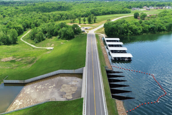
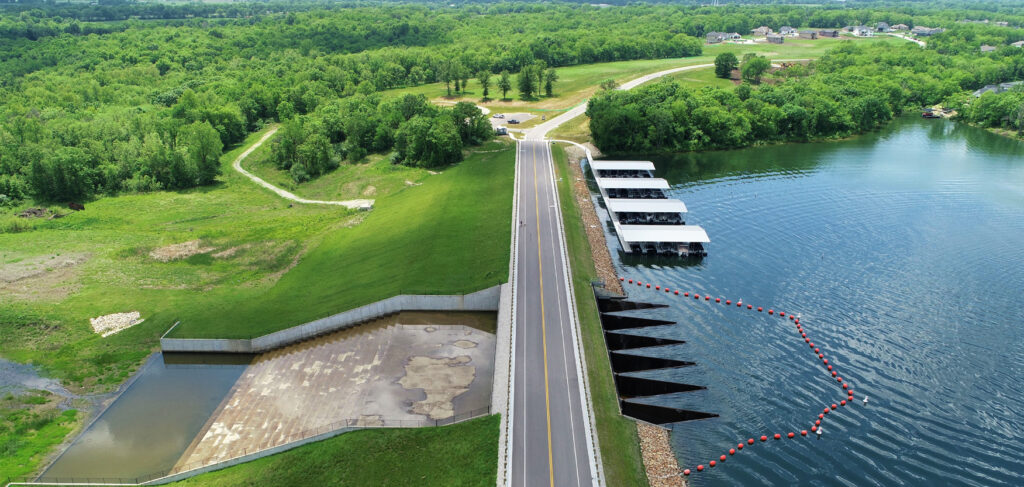
Lake Winnebago Lake & Community Expansion
Lake Winnebago Lake & Community Expansion
×RIC is the engineering program manager and design engineer on the Lake Winnebago Expansion project. Developer and land owner, Randy Spalding, selected RIC to be the lead consulting firm to help him achieve his dream of turning his 420 acre property just south of Lake Winnebago into an extension of the lake and subdivision. The lake and community expansion increased the overall lake surface area by 54% and added 323 residential lots as well as 10 acres of commercial space.
The existing Missouri State Highway 291 (M-291) also had to be widened and the intersection at 167th Street had to be redesigned to increase capacity. The M291 project included the design of the intersection of MoDOT Route 291 and 167th Street in Lake Winnebago, MO. Design included the widening of ½ mile of Route 291 to accommodate the addition of a Southbound left-turn lane and a Northbound right-turn lane onto 167th Street. It also included the widening of 167th Street to accommodate dedicated left and right turn lanes onto Route 291.
-
Compass 70 Development
Compass 70 Development
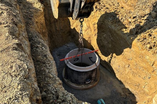
×RIC was hired by Scannell Properties to design a sanitary sewer collection system, lift station and force main to serve the 150-acre Compass 70 Business Park in Bonner Springs, KS. RIC worked with Scannell Properties and the City of Edwardsville to develop the design for the collection system and lift station. The project included approximately 1625 L.F. of 8” gravity main, 1016 L.F. of 4” force main and a lift station. The lift station was designed in conjunction with the City of Edwardsville design criteria and technical specifications, and input from the City’s on-call engineering consultants. The station was designed for a peak flow of 225 gallons per minute (GPM) for the proposed industrial park.
The lift station included submersible pumps in the wet well, valve and meter vault structures, control panel, electric meter, backup generator and a Primex Remote Operating System. The design process of the project included development of land disturbance plans and a Stormwater Pollution Prevention Plan (SWPPP). RIC also completed applications to KDHE for the project and obtained a Notice of Intent for Construction Activities and a Sanitary Sewer Main Extension permit. Project design started in Fall of 2021. Construction of the project began in Summer of 2022 and is expected to be completed in Summer 2024.

Location
Bonner Springs, KS
Services
Markets